As legend has it, one of my ole ski-mountaineering college buddies, from CU-Boulder, invented the word . . . Riking: (verb) A combination of Running and Hiking. Usually done when the terrain is too lung-bustingly steep to continuously trail run, a lower gear (in the form of Riking) is endured.
On Wednesday, I had a lil’ adventure at (and near) one of the local ski resorts. Usually, adventures start with a SLIGHTLY convoluted plan, and this one turned out to be no different. The magic began on Tuesday evening, as most of Western North Carolina was under a Winter Weather Advisory. I joyfully woke up to a dusting at my house. Even better, above 3500′ . . . measurable accumulation existed.
I drove up to Cataloochee, and saw the snowguns were FULLY FIRING! . . . my archenemy. No worries . . . I half expected Cat to be taking advantage of this wonderful cold air, as they were pumping-out, what will be, a mega-base. I took a couple of runs through the artificial blizzard, and captured this photo in-between running the gauntlet:

The beauty of having a season pass is the freedom to hand pick my days on the snow. Instead packing it up and feeling defeated, I looked to the (proverbial) west . . . there lies Hemphill Bald, a monster of a mountain at 5600+’. While only 200+’ higher than Moody Top (the highest point at Cataloochee ski area), access to Hemphill is arduous, as can be seen below.

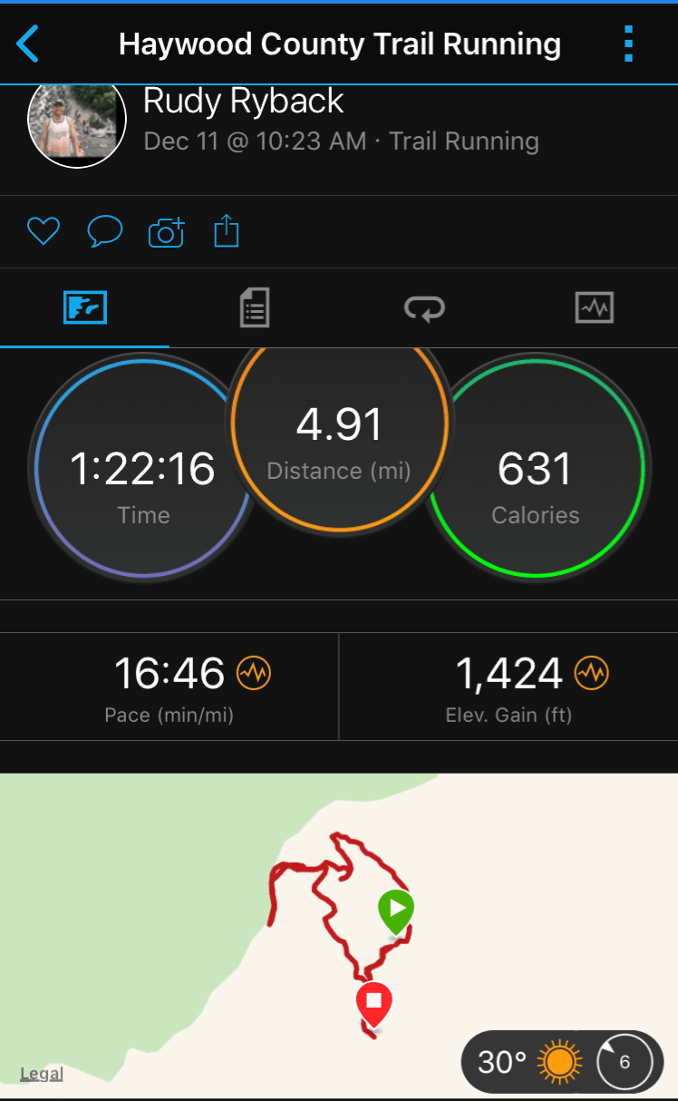
I put on my trail-running shoes, and with ski/hiking poles in hand, set out from the ski lodge, which sits at 4660′ From the lodge, look to the north and you’ll see a little trail cut . . . This is the Brer Rabbit Trail.
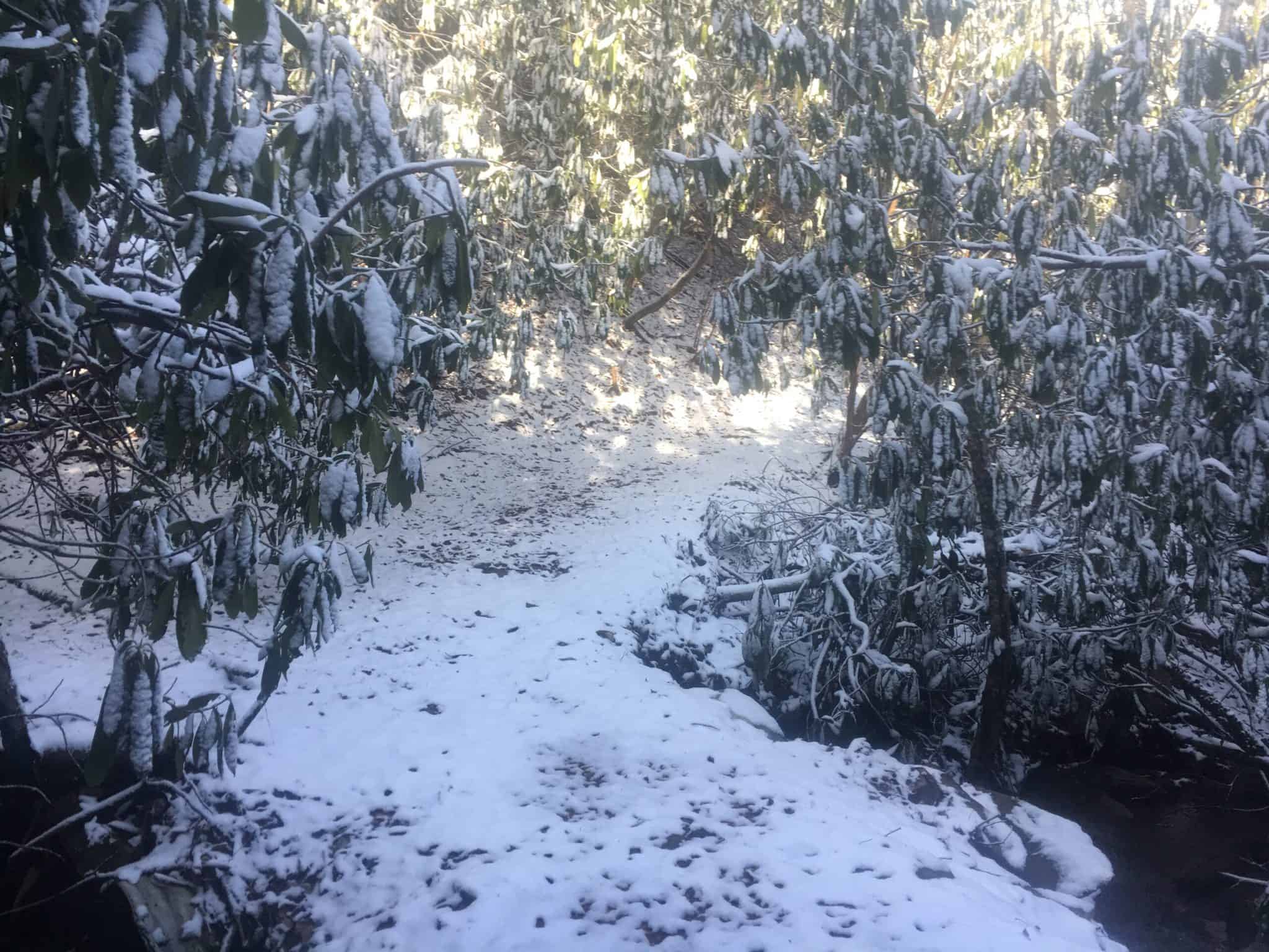
From here you will actually descend a little, where there is access to a waterfall on right. The sign to the waterfall is the low point on the hike, at 4600′ . . . nearly 1000+ vertical feet of climbing lies ahead!
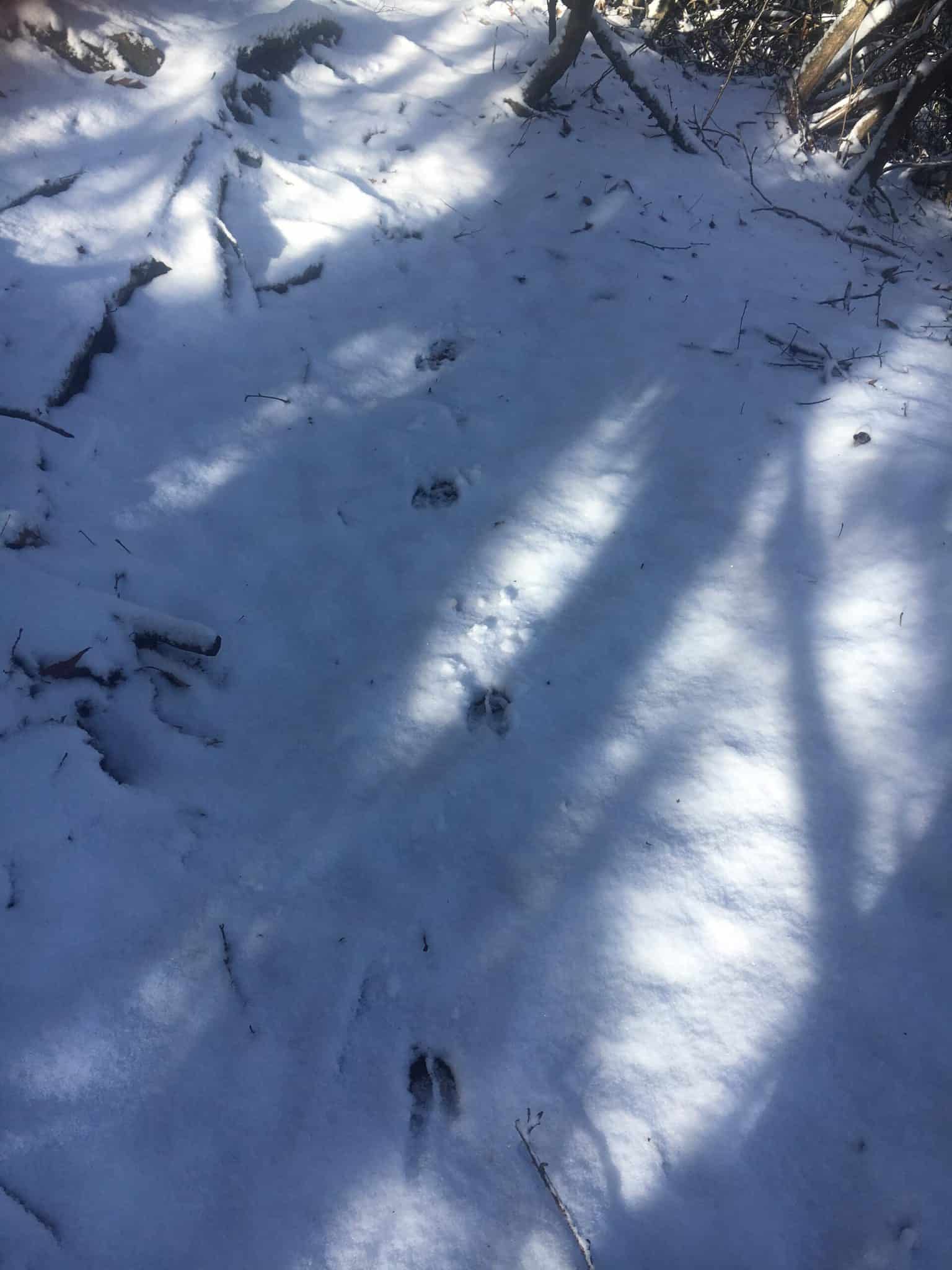
I started the climb, and about three-quarters of a mile I found myself at the junction of Brer Fox Trail and another unnamed trail (that leads to the Swag). I took Brer Fox and was starting to get into my (physical) groove. My mind, too, began to wander when suddenly, I was stopped in my tracks . . . animal prints in the snow! The first set of tracks looked like a deer, and I grabbed this photo:
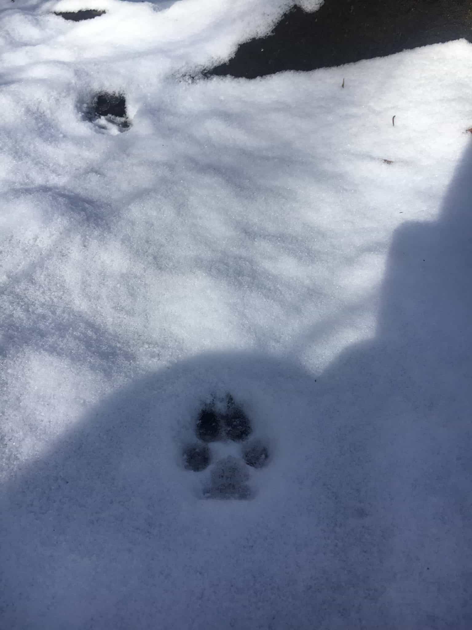
Soon after, I came upon ANOTHER set of tracks. This one had two little claw marks toward the top of the print . . . coyote? Seems plausible. At this point, I am nearly toward the edge of Great Smoky Mountain National Park.
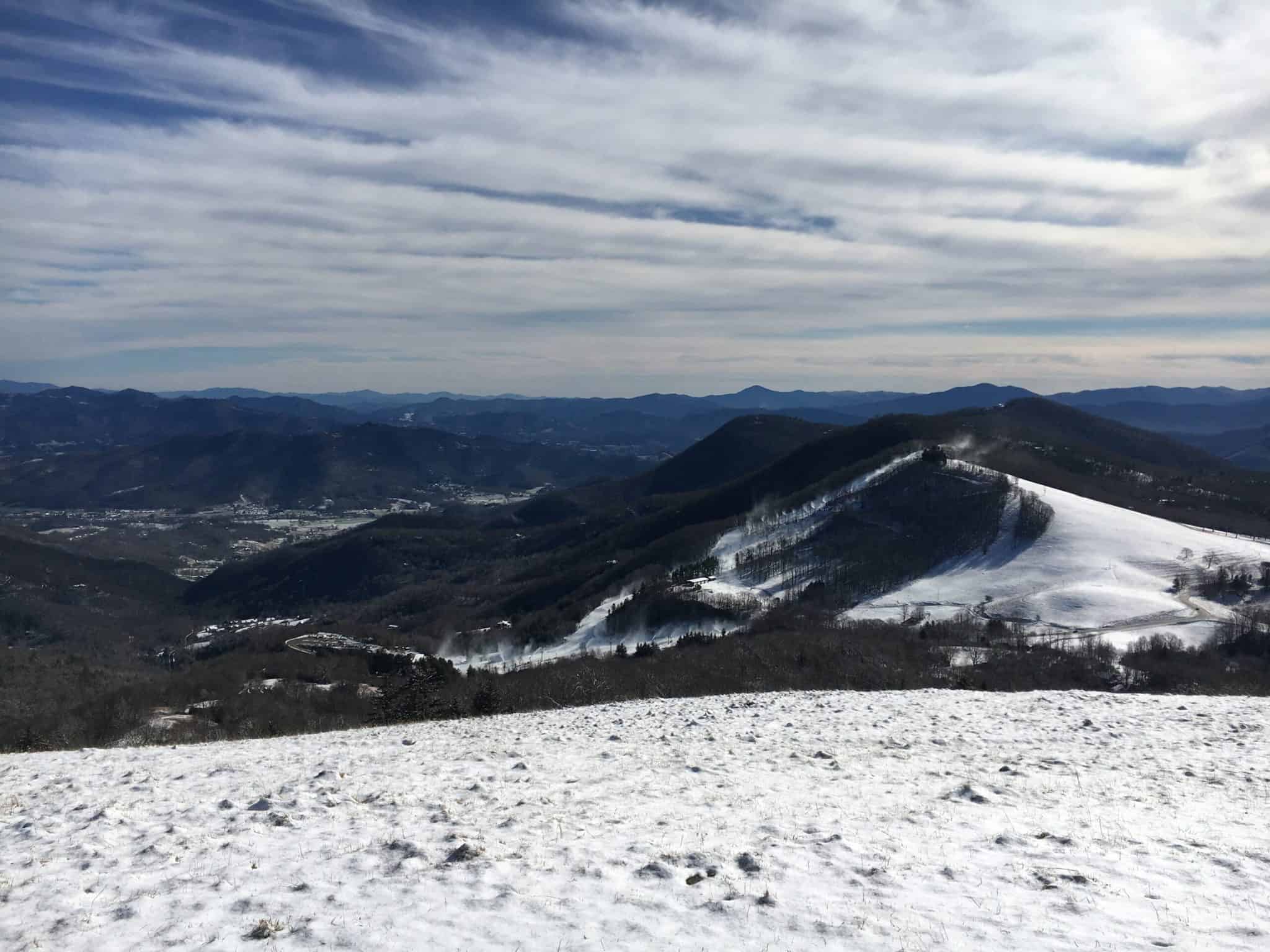
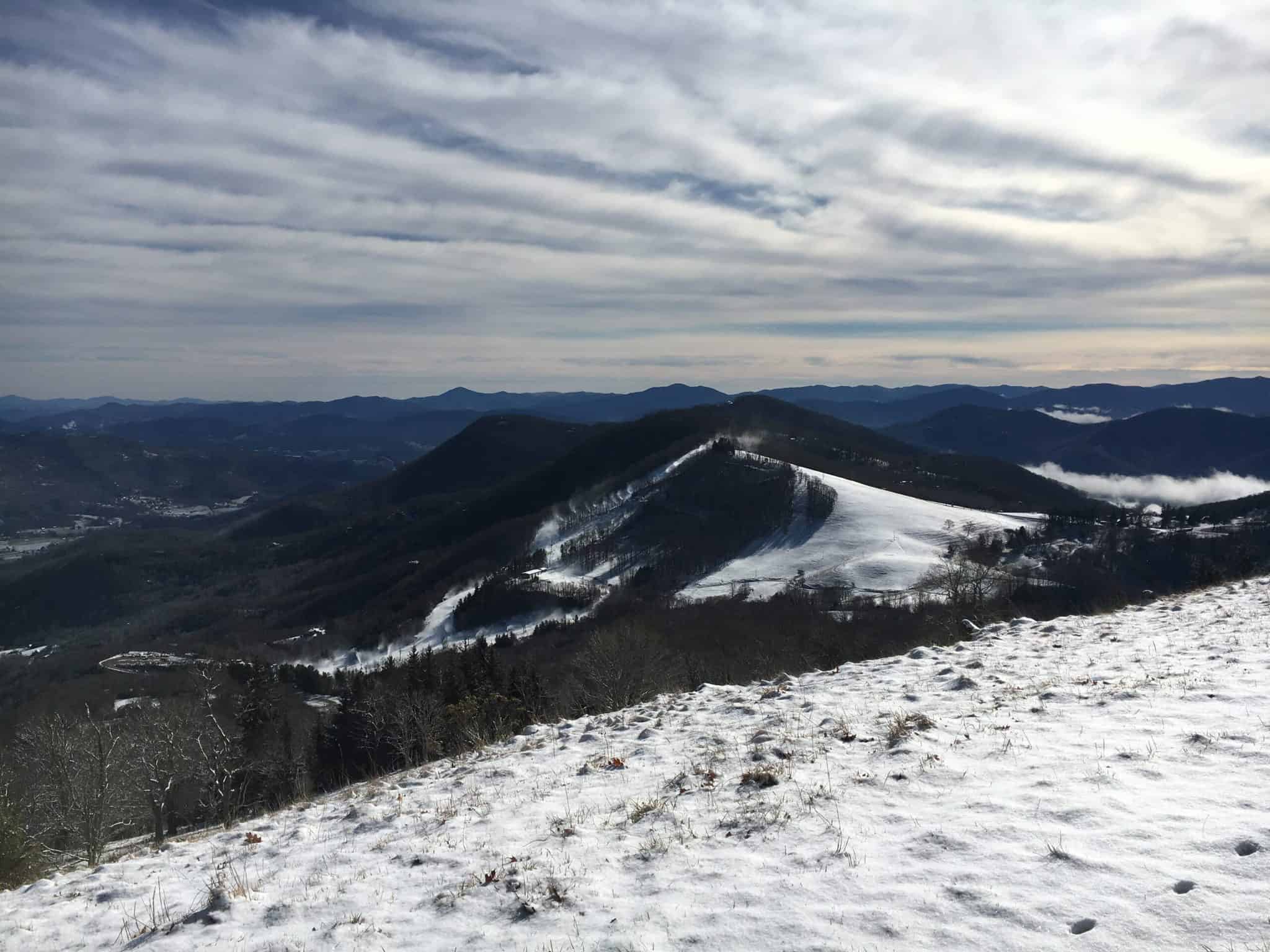
I hit the Cataloochee Divide Trail, made a left, and began the ridgeline-proper ascent toward Hemphill. I passed through a couple of cattle gates and was awarded this spectacular view, above tree-line:
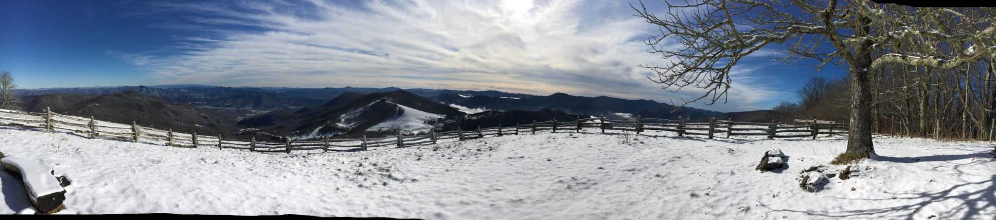
Pressing on, I reached the summit nearly 50 minutes from when I started. Just before my phone battery cut-off, because of the blustery, cold weather, I snapped this panoramic shot.
It was windblown up there so I didn’t stay for long. I took the (easier) ‘Red Trail’ back down, past Saltin’ Ground, to the ski lodge. What an awesome, snowy day at Cataloochee!