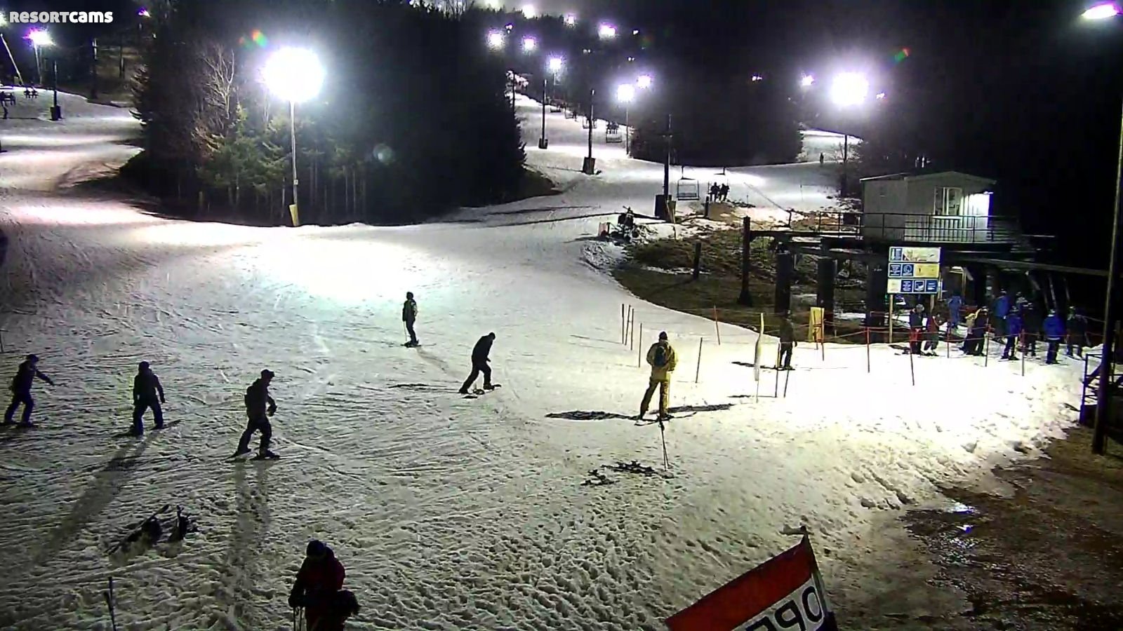
(The photo above shows really nice conditions for night skiing last night at Snowshoe Mountain.)
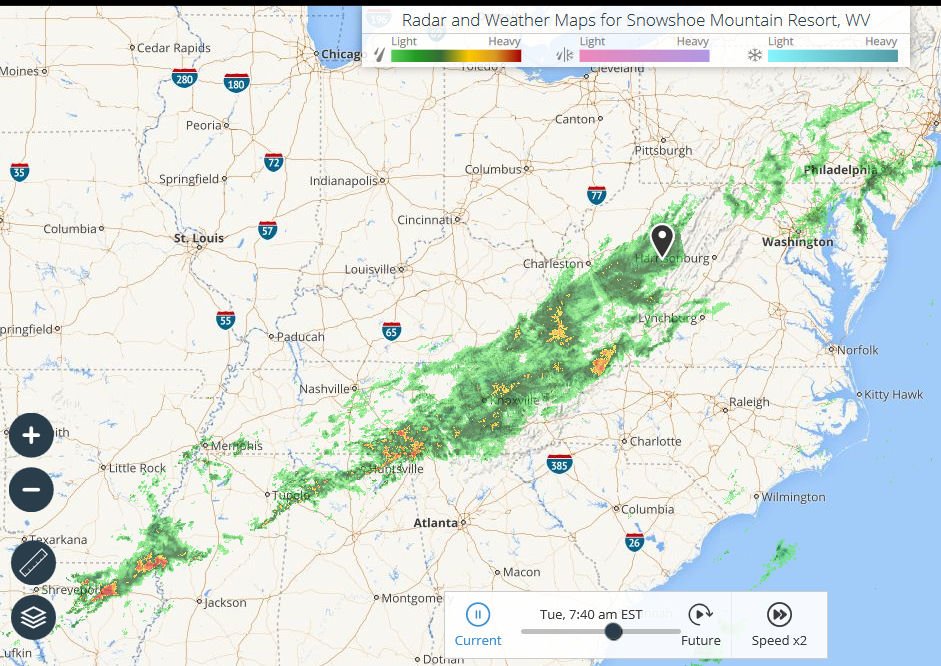
Updated 10am: Already seeing clearing skies especially in the WV, MD and Virginia ski areas. Things are looking up! Tour the LIVE CAMS!
Day one of my Holiday getaway was everything you’d want in a day one. The day after Christmas is traditionally the busiest check-in day of the year. You can usually expect long lines waiting to check-in and often your rooms aren’t ready until 5pm or later. Getting a seat at a restaurant can be a challenge, especially for larger groups. Add to that were my own personal expectations of things being a bit wet and thus more slushy or icy on the slopes.
Well forget EVERYTHING I just shared. We got packed up in a misty, wet rain on Sunday night and threw the remaining items in the back of my truck in a heavy, wet fog Monday morning and hit the road by 6am. We were already in Lewisburg, WV by 9:30am after stopping for breakfast in Mountain City, Tennessee. We shopped for groceries for an hour at Wally World in Lewisburg and then made the trek up Hwy 219 and got to the bottom of Snowshoe Mountain at around 12:30pm. I was shocked when April (the best office manager of any real estate office on the mountain) said, “Mike you’re going to love this, but we have your unit already cleaned, beds made and waiting for you.”
That is almost unheard of. So we drove up the mountain and emptied our gear in about ten minutes. Arriving early doesn’t always work out, but it did this time around. We went to Foxfire Grille for lunch and got there and was seated in about two minutes. While we were there the place got packed. We ate and then walked over to The Depot to grab our season passes. I expected a wait there. Nope. Walked right up to the counter and collected four season passes. While we were there, the place got packed.
We then headed over to Allegheny to check-in for several of our guests as we had rooms at Mountain Lodge as well. We walked in the door and were immediately greeted by a concierge from Australia. She quickly informed us that two of the three rooms were already available to us (3pm) and we got those and headed over to make sure everything was ready.
About an hour later, some of our additional crew arrived and we walked over to Allegheny to meet them and the place was wall-to-wall packed. Some time later we went back over to The Depot to pickup passes for our friends and the line was almost out the door. However within about ten minutes we were at the front counter, assisted and out the door.
Typically after the long drive up, we don’t hit the slopes on that first day. However with the strong threat of rain in the Tuesday forecast, we decided to hit up Silvercreek for some turns. I was expecting slushy conditions and lift lines of maybe 10-15 minutes per turn. NOPE. The conditions were IMPRESSIVE and that is not a “qualifying impressive” like – man the conditions were really impressive when you consider how weird the weather has been.” NO, these were impressive conditions, period.
The snow was soft but not slushy or icy. It was consistent snow from top to bottom and not alternating – nice, icy, deep slush, etc. It was simply, really, really, REALLY good on every slope we hit up. There were no thin coverage areas – just really good snow top-to-bottom. I am so glad that one of the guys in our crew wanted to go, because I would have probably opted to chill out and be lazy. Instead, I was able to make some awesome turns with my daughter and her boyfriend.
Lift lines were non-existent, which surprisingly you can experience on most nights skiing on that side of the mountain. The slopes were not crowded, but certainly busy and we made eleven turns down the mountain in about an hour and fifty-seven minutes according to our TRACE APPS.
 Interestingly, when I crashed for the evening TRACE alerted me that my turns were the 5th fastest average time for the day of all the people who skied or rode the mountain today. If you haven’t downloaded TRACE you really should as it just adds a little touch of fun to the experience. One of my really good buddies uses it all the time and he and I have some good-natured fun and competition to see who goes the fastest, etc. I know Ron is reading this – so dude you’ve got me by 2.5 mph on max speed so far this season. I’ll pass you today!
Timing is everything with ski trips and Monday’s timing was impeccable and such amazing good fortune. Like I said earlier – it rarely goes that way. That’s when another helpful trait comes into play – patience. I’m certain we’ll be tested a time or two as we go through the week ahead.
Let’s Talk a Little Weather…
So last night was awesome. Dry and the slope conditions were pretty, freaking great. As I got up this morning, the first thing I noticed was the howling winds that were roaring against my window. Part of that is that it was really windy. The other part is that I happen to be staying in a Highland House unit that is the on the corner facing the Village and that place is a wind-tunnel on calm days, so we’ll see how the rest of the place feels when I get out and about.
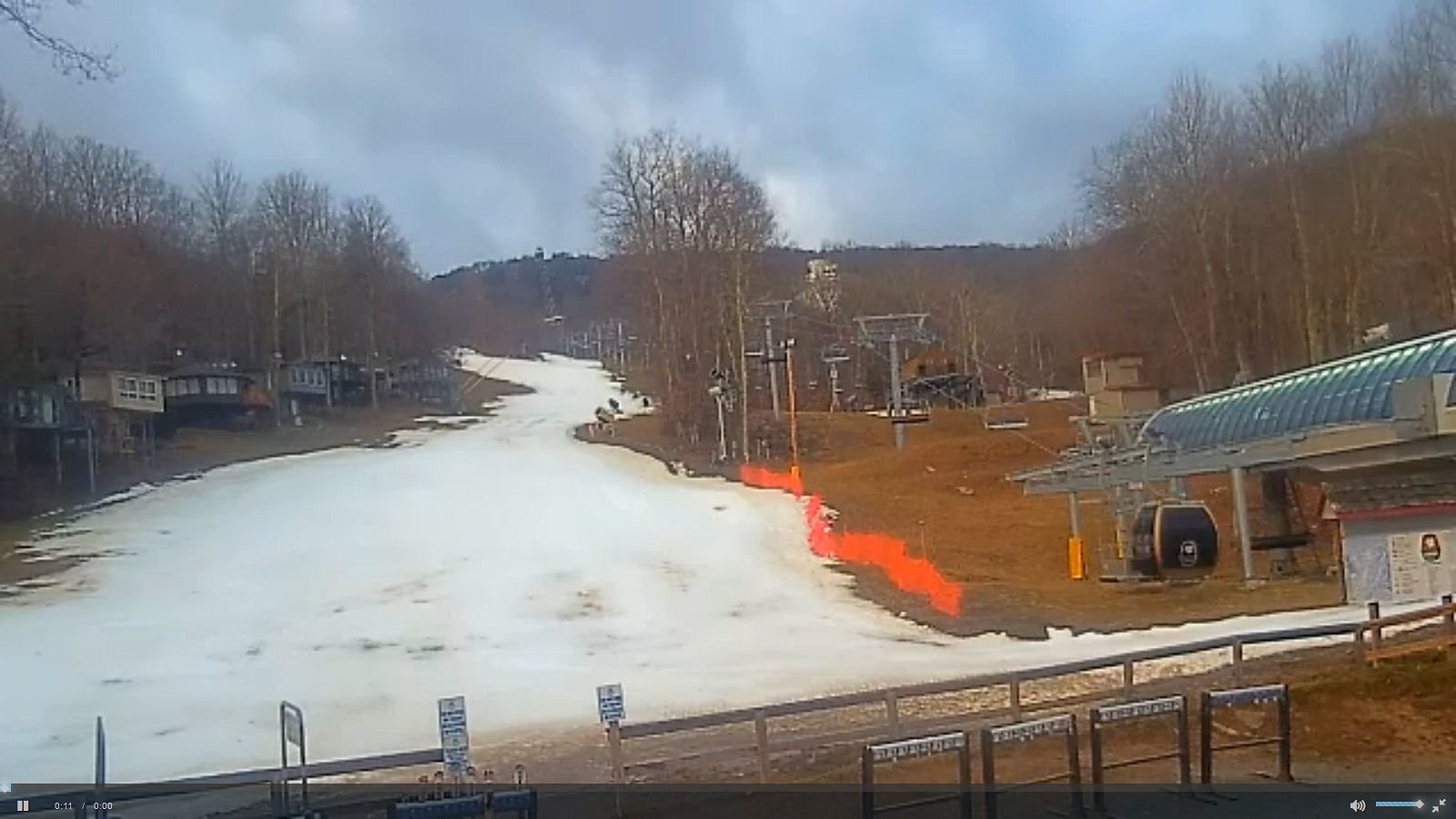
(I snapped this quick video showing how gusty the conditions are this morning. Things will improve greatly throughout the day.)
That will have to be an hour or two later than I like as it is raining pretty hard as I write this morning report (8am). The forecast is for the winds to push the wet and warm air out of the area and usher in MUCH colder air and even some snow!
Shawn Cassell’s team here at Snowshoe wrote this:
“It’s our last warmer day for a while, so get out there and enjoy before the cold air gets here. With falling temperatures throughout the day, our snowmakers should be able to fire up the guns tonight to put a fresh coat on everything, as well as continue working on new trails.”
We’re watching the wet front move through our entire ski coverage area this morning. The forecast for most of the region IS for some scattered to not-so-scattered showers through today. The most southerly portion of the front will trail some moisture and prolong the showers until mid-afternoon while the ski areas in West Virginia and Virginia should be CLEAR by lunchtime.
As Shawn mentioned above, the temps should fall throughout the entire area throughout the day and there are strong chances that we will see snowmaking crews crank up and make snow throughout the region tonight! Worst case scenario, grooming crews will push the snow around and cover-up any thin areas to make for good conditions today and (Wednesday) and then snowmaking will REALLY kick in on Thursday as temperatures nosedive.
We’re still seeing good chances of light snow across the higher elevations of the North Carolina and as much as 5-9″ of snow for the West Virginia and Maryland ski mountains as we get into Thursday and Friday of this week.
It rained a good bit overnight and this morning looks a little soggy early – but from what we’re seeing things should clear out today and offer a nice day on the slopes later in the afternoon and night. Expect a light shower or two today and some gusty winds as this wet system exits and ushers in some well-timed cold air and even some SNOW.
Those resorts that do a great job of adjusting base depths on a daily basis (Beech, Cataloochee, Sugar) all are showing a drop of 4-6″ in the last 24 hours which is indicative of the rain the entire region experienced. That would seem to also dictate that you’ll see some thin coverage areas out and about.
This is where the LIVE WEBCAMS really come in handy. I noticed some thin coverage areas at Omni Homestead, Beech Mountain, Cataloochee and Sugar Mountain – but I can tell you that with the rains we’re seeing – there will be some thin coverage areas pretty much at all ski areas. For the most part though we think you’ll find REALLY GOOD, side-to-side coverage and plenty of skiable terrain for this last mild day of the year and then with lots of snowmaking things will really look nice for the rest of the week.
Ski areas for the most part are offering the same trails available today – compared to Monday. The only drops in slopes open in the last 24 hours were at:
Cataloochee dropped one trail,
Beech Mountain dropped three,
Ober dropped one.
So let’s get through this last mild day and some on-again, off-again showers and look for the snowguns to crank up at your favorite ski resort.
Now that COLD AIR and some SNOW is on the way, I thought I’d share some insight about just how weird the weather has been over the last few Decembers. I looked at some archived data and the last THREE December 26 dates have been warm with highs in the upper 50s to low 60s in each of the last three years. You have to go back to December 26, 2013 to see a normal temp. The high on this date back in 2013 was 29° with a low of 20.8°.
In each of the last three winters, things were milder than normal for December with very little snow. As an example, last winter Beech nor Sugar saw ANY snowfall in December. They finished with about 70″ on the season. You have to go all the way back to the 2012-2013 season when Beech and Sugar saw 104.9″.
HOPEFULLY things will trend towards colder and snowier after the first of the year (next week). There is some snow in the forecast for later this week, particularly up here where I’m at this week! (Sorry if I’m rubbing it in a bit. Again, so far our timing has been blessed to say the least.)
Kenny Griffin and I are keeping an eye on things across the region from our temporary outpost here at Snowshoe this week. We’ll also hope to get an update from Meteorologist Brad Panovich.
In closing – I loved looking in at Ober’s comments this morning as they evidently agreed with our story of rain-skiing the other day. They wrote, “Slopes open at 9 am today and will be open rain or shine. Dress for the weather and be ready for some fun! These warm Christmas temperatures have decreased the slope base, however we are looking forward to snow making temperatures coming our way possibly tonight or Thursday night.”
That’s going to do it for me today. After having such a great night of skiing last night, we will not be braving the elements today. We’re going to do a little side-excursion to Elkins for some off-slope fun and then head back to Silvercreek for some turns this evening.
Hopefully I’ll have more great news to share.
#THINKCOLD
#THINKSNOW
#THINKSAFEHOLIDAYS!
That’s going to do it for me. Email me as you prefer at: [email protected]
 If you have not signed up for our newsletters or push notifications, there are a couple of ways that you can be among the first to know when we post anything from FirsTrax news to Featured Photos & Videos to Announcements (like FREE Lift Ticket and Vacation Giveaways!).
 If you have not already signed up for Push Notifications, click on the little BELL in the lower left corner of your screen and you’ll get the prompt to signup.
You can also sign up for our Newsletters that we periodically send out with specials, and weather announcements.
 Also keep “tuned” to ResortCams.com.There’s no better way to see just how great things look at YOUR FAVORITE ski resort.
 Also keep checking www.HighCountryWeather.com and all of the dedicated URLS for the ski mountains such as BeechMountainWeather.com, SugarMountainWeather.com, SnowshoeWeather.com, WispResortWeather.com and more. (17 in all!).