WHAT THE EXPERTS THINK
Hello Everyone –
Here’s some good news for skiers and snowboarders out there, just in case you haven’t noticed, things have been pretty busy at all of the ski resorts in the region recently because Mother Nature has provided some excellent snowmaking conditions. I saw Winterplace’s snowmaking operation from Interstate 77 last weekend and they are going to be in very good shape when they open for the season December 12. Again this year, the first alpine resorts to take advantage of the favorable snowmaking situation were Sugar and Cataloochee in North Carolina. The first Nordic Area to open this year was White Grass Touring Center in West Virginia as that back country area offered cross country skiing and snowshoeing when natural snow fell in the backcountry of Tucker County this past week.
Like I have done since starting this column ten years ago, I thought for my first column of the season, I would check out what some weather experts thought was going to take place this season for skiers and snowboarders in the Southeast and mid-Atlantic regions. I have seen a lot of pictures and video from resorts in the region of snowmaking and things are looking very nice. So I wanted to look into the snow globe a bit to see how some weatherman felt about the upcoming season. So here goes.
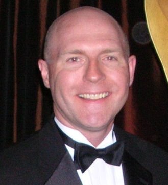
 I first spoke with Spencer Adkins, Chief Meteorologist for WOWK-TV in Charleston/Huntington, WV and see what is on his mind: For starters, once again we had snow flying as early as October in West Virginia in the ski resort areas which has quite often been a signal of a very good ski season.
In recent years I’ve been a big fan of looking at the patterns that set up as early as October for hints about the coming few months ahead. So far what we have seen is pretty cold. The high terrain has already seen several rounds of snow and the resorts have been busy making snow. To twist a phrase from Meghan Trainor, when it comes to skiing around here, resorts are “all about that base.”
Looking at the official Climate Prediction Center call for winter, they have the region once again in an “equal chance” of warmer or cooler than normal zone as well as equal chances of more or less precipitation. It’s basically a “50-50” call. They have well-grounded reasons, and I’m not one who has ever been accused of being a “snow goose,” but I have to politely disagree and lean toward more snow than normal this season in the West Virginia ski resort areas.
First, the pattern has been cooler than normal over our part of the globe, despite warmer than normal temps in many other areas. Cold air and ground temps have a head start here. Call me stubborn but the southerly dip in the jetstream from the Upper Plains to the Tennessee Valley and our part of Appalachia and the Great Lakes has been there now for months as the overriding pattern, going back to last winter. A (warm) ridge in the West and (cold) trough in the East is known as the positive phase of the Pacific North American jetstream flow. Looking for evidence of a pattern breaker doesn’t yield many results or consensus among people who deal exclusively in long range forecasting as to when that PNA may flip flop to a long term negative (warm East) phase.
There are numerous other global jetstream patterns that come into play. Just looking at the big waves and circulations that set up in the Northern Hemisphere upper air, we’ve already seen two very large bubbles of Polar air break south. Knowing that such patterns tend to be repetitive until some new forcing mechanism takes over, it’s not unreasonable to think that we will see similar patterns again and again.
Of course we will see a few warm spells that last a few days here or there, but overall I believe this will be a colder than normal winter. I don’t think as cold as last year but colder than normal. This means the Great Lakes waters can stay open a little longer than last year as a source for moisture needed for snow. Persistent cold northwest winds will help guide the overall airflow up the slopes of West Virginia and that spells highly efficient natural snow production. In these conditions, resorts can really make some great snow as well. Of course we always see a nice southern storm system but the bulk of ski resort natural snow comes from the northwest flow pattern.
So if average snowfall is about 150 inches in the West Virginia resort areas, I think we can easily see that much and likely many more inches on top this season which means great skiing, riding, tubing and sledding conditions. If that proves to be true for our slopes. every inch of snow is perfect from the bottom to the top. (Sorry Meghan.)
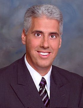
 Let’s go to Sean Sublette, Chief Meteorologist for WSET-TV in Lynchburg/Roanoke, VA. Here is what Sean is forecasting: As always, seasonal outlooks are tricky. Sometimes the clues are strong, sometimes they are not.
One of the clues that has shown some skill is the rate of snow cover development in the Asian Arctic in the fall. When the snow cover develops quickly, it often supports colder than normal winters in eastern North America. That snow cover growth there has been strong so far.
As a result, there seems to be a consensus that a colder than normal winter is ahead for eastern North America. This would suggest several opportunities for snow on the west-facing slopes of the West Virginia Appalachians. In addition to the classical snow storms, repeated shots of northwest wind that come with these cold outbreaks will help squeeze out snow and allow for frequent snowmaking.
If you would like to see what Sean thinks about global warming, check out his blog:
http://seansublette.wordpress.com
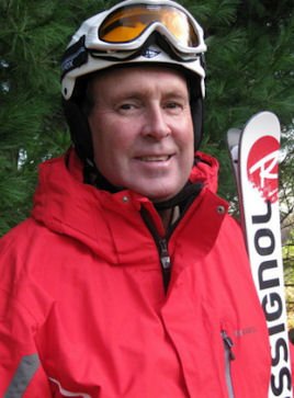
 Now let’s check in with Joe Murgo, Chief Meteorologist for WTAJ-TV in Altoona, PA. Here is what Joe thinks:
My complete wintercast is here: http://www.wearecentralpa.com/story/d/story/wintercast2014/10577/RCU7gTDGx0ecxHhLasU_w
But to summarize my thoughts. Too much was put into El Nino for the government forecast. It’s going to be weak and that leads to other factors taking over. With the waters in the northeastern Pacific being warm it will set the stage for a ridge in the jet stream to want to pop into Alaska which then opens up the gateway to arctic air masses to move into middle and eastern US. That was the case this November and we should have repeats through the middle of the winter. While I don’t think it will be as cold as last year, it’s going to lean colder than average. That flow also enhances the snowfall for the mountains from West Virginia to North Carolina.
Also, the waters off of the Atlantic coastline are warm. This sets the stage for storm development. No guarantee but this stacks the odds for one or two big ones moving up the East Coast.
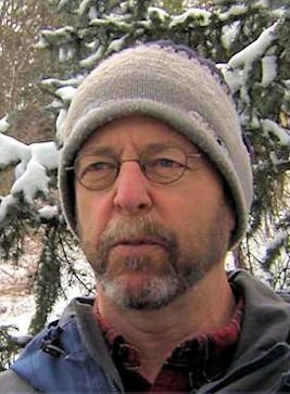
 Finally, we turn to Herb Stevens, a long-time meteorologist and recognized for over 25 years along the east coast as The Skiing Weatherman; his thoughts on this season’s weather is as follows: As we enter this winter season, I can summarize my forecast quite simply. In the 30 years or so that I have been producing long range seasonal outlooks, I have never had such unanimity among the more than a dozen indicators/influences that I study before issuing such a forecast. Virtually every one of them points to a colder than normal and snowier than normal winter over the eastern half of the country, and that certainly includes the central Appalachians.
The weak to moderate El Nino is the primary driver behind the forecast, but stratospheric winds over the tropical Pacific, the distribution of sea surface temperature anomalies in the Atlantic and Pacific, and the current state of the solar cycle are a few of the factors that are in sync regarding the weather to be expected over the next 3 to 5 months. If this winter doesn’t turn out to be a solid one for skiers and riders, I might have to go back to school from remedial meteorology classes. It is worth noting that when a weak El Nino is in place, as it will be for many more months, March turns out to be a month that belongs to winter more than spring, so skiers and riders shouldn’t be shy about taking advantage of the great deals that are available later in the season.
 That’s it for the season’s first column, more to come as the season continues, just remember whether it be cold or whether it be hot, we’ll weather the weather, whatever the weather will be. Think about it! See you on the slopes.
Send your comments to: [email protected]
Joe Stevens, a member of the southeast ski industry since 1990 is a regular columnist for skisoutheast.com and serves as the Communications Director for the West Virginia Ski Areas Association.