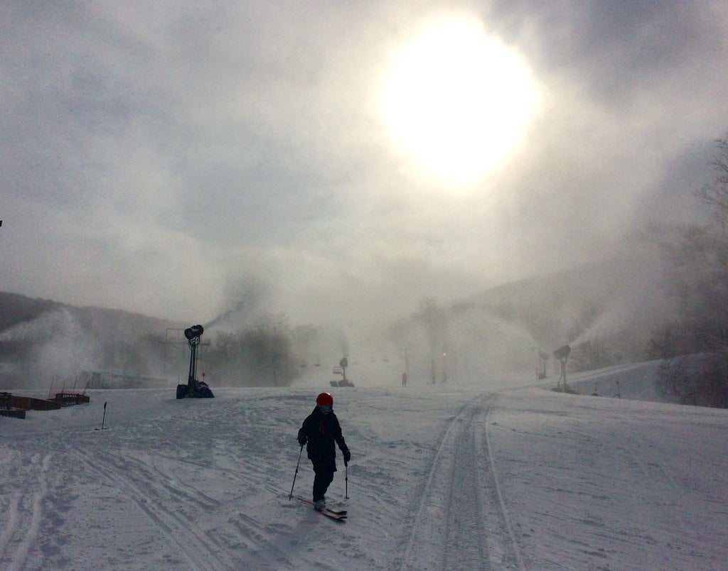
The work week is almost over and what a great week is has been! The Northwest Flow snow machine dumped 12-18″ of snow for about half of the ski resorts in the region and while some of the resorts didn’t see much in the way of natural snow, everyone has been furiously making snow thanks to some bitterly cold temperatures. I’d say this has been the most productive week of the season and it couldn’t have come at a better time just before the always important President’s Day holiday weekend.
Just to recap the snowfall totals so far for the week, here are those numbers. No snow has fallen since yesterday morning except for up at Canaan and Timberline, where David Lesher is reporting a little under an inch (0.7″ to be exact).
App Ski Mtn – 2″
Beech Mountain – 18.5″
Cataloochee – 5″
Sapphire Valley – Trace
Sugar Mountain – 14″
Wolf Ridge – 13″
Canaan Valley – 18.8″
Snowshoe – 15″
Timberline – 18.8″
Winterplace – 8″
Maryland
Wisp Resort – 12″
Tennessee
Ober Gatlinburg – 9″
Bryce Resort – Trace
Massanutten – 3″
Omni Homestead – Trace
Wintergreen – 1″
Snowshoe put out a video yesterday that highlights just how good it has been up there this week. And man oh man is it good. I feel the need for powder after watching it.
I am super jealous of anyone who was up there over the past few days. Or any ski area in the region for that matter. Midweek skiing and riding is always the best, with less crowds and what not. Mix in some powder and you can’t beat it. I can’t wait to finally get on snow this weekend!
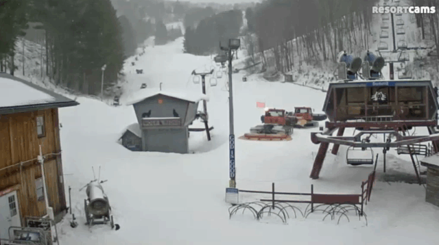
Here are a couple other social media posts from yesterday showing how nice of a day it was.
I’m not sure when this one was taken, but it’s a cool drone shot of Massanutten nonetheless. Mike and I love us some drone shots, so I’m posting it because I can. Hit the play button.
Weather Outlook
A quick moving system is going to dump a little more snow at many of the resorts today and tonight. I was scanning the cams and it was actually coming down pretty hard at Ober Gatlinburg this morning. Temperatures were borderline though so not sure how much was accumulating.
There were also some flakes to be seen at Wolf Ridge.
The snow today and tonight is mainly for the North Carolina and West Virginia ski areas. Tomorrow might be another powder/mini-powder day up in West Virginia. The NWS forecast for Winterplace is calling for 1-3″ today and another 1-3″ tonight. The high end of that would be another 6 inches! For Snowshoe, the forecast is for 1-2″ today and 3-5″ tonight. The high end of that forecast range would be 8 more inches on top of the 15 they have already received this week! That would be a heck of a way to start the holiday weekend.
Lesser totals are expected down here in North Carolina but a few inches are possible for Beech, Sugar, and Wolf. A little layer of fluff on the slopes tomorrow morning at Beech sure would make my week! I’m intrigued to see how much the mountain is filled in compared to last weekend when I was up there and there was no hardly any snow outside of the trails.
 My daily thing this week has been to remind you all about the extreme cold this weekend and I’ll do it again this morning. High temperatures tomorrow are going to be FRIGID. They won’t get out of the single digits for some resorts and wind chills will be in the negatives. I kid you not, the NWS forecast high temperature right now for Snowshoe tomorrow is -1. With a wind chill as low as -30. Whoa. Only the hardcore will be getting that powder first thing tomorrow morning!
Here’s that broken record….BUNDLE UP. Make sure you have plenty of layers and try not to have too much skin exposed. Hand and toe warmers are a must as well. You’ll thank me later.
Sunday looks a little warmer. And by warmer I mean temps will be in the teens and 20’s.
One of the things that I noticed on the snow reports this morning was that many resorts either had snowmaking marked as off or they specifically noted that snowmaking won’t be taking place this weekend during operating hours. Sugar Mountain wasn’t making snow this morning (or yesterday I believe) and they are probably the most aggressive ski area in the region when it comes to doing so. Beech even put an announcement on their site…
In order to provide a comfortable experience for our customers, Beech Mountain Resort will not be making snow this weekend. Please be advised that it will be cold, so dress appropriately.
I have a feeling many of the resorts will be doing the same this weekend and only making snow at night. I like the strategy as the cold would just about make it unbearable if the guns were going as well.
Monday/Tuesday Storm
The Monday and Tuesday timeframe still look interesting right now for the potential of a big snow. There’s still a lot of uncertainty about the snow mixing with sleet and rain. This would happen moreso later on Monday and Monday night. Right now it looks like the first half of Monday should be fine with snow only, so the final day of your holiday trip should end on a good note for the most part.
Mike will keep you updated on this over the weekend and I’m sure Brad Panovich will have a video update as well.
For a complete look at current base depths, snow conditions, open trails and more, check out the snow reports page.
https://www.skisoutheast.com/snow-reports/
Peak season conditions are here. I can’t believe it’s already the middle of February. This seriously could be the best weekend of the season, so get out and get some!
Think cold and think snow.