Hello Everyone –

During later part of October I got to meet Hurricane Sandy up close and personal. I am here to say she was anything but a lady, putting millions of people out of power and out of their homes for weeks. What she also did was drop tons of snow in the Mid-Atlantic mountains giving the ski resorts some momentum going into this season.
A Beckley, WV Couple Digs Out after Sandy (Photo by Jon C. Hancock / AP with permission)
The first alpine resorts to take advantage of the situation were Sugar and Cataloochee in North Carolina but the first area to actually open and remain open was White Grass Touring Center in the north central region of West Virginia. That area has been offering cross country skiing and snowshoeing since late October and hasn’t looked back. Snowshoe Mountain opened Thanksgiving week, which is a traditional opening and the season is off and running.
So I just thought for my first column of the season, I would check out what some weather experts thought was going to take place this season for skiers and snowboarders in the Southeast and mid-Atlantic regions. I have seen a lot of pictures and video from resorts in the region of snowmaking and things are looking very nice. So I wanted to look into the snow globe a bit to see how some weatherman felt about the upcoming season. So here goes.

I first spoke with Chief Meteorologist Brad Panovich of WCNC-TV, Charlotte, North Carolina and here are his thoughts: The region will be much colder than last winter which isn’t saying much. But I think we will see something more similar to the 2010-2011 winter. Lots of arctic outbreaks with loads of Northwest flow snows. The persistent blocking we have seen this fall in the north Atlantic will be common place. This should allow for numerous cold outbreaks and coastal storms. The favored storm track looks to be a coastal low/nor’easter track like we saw with Sandy.
Combined with frequent Alberta clippers it should make for a great ski season. I have much more confidence in the cold air right now than the storm track. So while I can see several big storms this winter. I wouldn’t be surprised either if it’s cold or dry. Especially if the coastal low tracks are too far offshore this upcoming winter.
 Let’s check in with Spencer Adkins, Chief Meteorologist for WOWK-TV in Charleston/Huntington, WV and see what is on his mind:
"Welcome to ski season 2012-2013! We’re off to a ROARING start in West Virginia as you well know with Snowshoe Ski Resort opening well ahead of normal thanks to Superstorm Sandy. That was truly a monster storm on so many scales. Much of the Allegheny Highlands saw more than 24 inches of snow and some spots saw over 36 inches of snow. So, it wouldn’t take a genius forecaster to say we have a pretty good shot of at least having an average winter snowfall in the region this year.
I tend to think we “wake up” to recognizing winter storm track patterns a little too late. I think once you see the late fall pattern develop, you have a good clue as to what to look for. So far in late fall we have seen the east coast low as the primary driver of rain and snow. The lows to date have developed in the southeastern United States and taken off as they hit the warm Gulfstream waters. However, outside of Sandy, the door hasn’t been opened yet too much with upslope snow off the Great Lakes. I suspect upslope is going to be big for the ski resorts once again this year. Upslope snow is caused by moist air from the Great Lakes rising up the mountains, cooling as it rises and dropping snow on the western faces of the mountains and the peaks immediately above.
Cold winds coming across Lake Michigan and Lake Huron can easily produce good 6-10 inch snowfalls in the course of a night with the snow being that light, fluffy quality. Remember, behind a low that passes south or east of the Allegheny Highlands, or behind any cold front that rolls over the area, the northwest wind is a good snow maker! Light, fluffy snow can easily come in streamer bands and upslope snow off the warm Great Lakes. My gut tells me that’s where the majority of the snow for the rest of the season will come from. Not saying we won’t have another nice shot from a Nor’easter, but probably nothing like Sandy.
Given the fact that you can see 6-10” of fluff in one night after a low or front, and if we were to average an event every 7 days, with 6-10 inches of snow on the high peaks, we’d have anywhere from 84 inches to 140 inches of new snow from this writing through mid-March for the high terrain of West Virginia above 4,000 feet. Snowshoe averages 180 inches of snow per season. My total range for them would be 120-176 inches of snow which is a wide window, so let’s roll close to the middle with a call of 147.5” for them. (I’m not a gambler but Vegas uses half points for a reason.) With that reasoning Canaan Valley and Timberline would be closer to 110 inches and Winterplace around 90 inches. Just a little below the average snowfalls for those resort areas.
The El Nino / La Nina see-saw battle is sort of stuck near a neutral phase. That’s why you’re reading lots of different projections on what the winter will be like depending on different sources. In fact, I just read a nice piece from government and university researchers that basically said: anything can happen. Sooo, I think it’s going to be a lot more important for weather savvy skiers to clue into the Arctic Oscillation. Remember, when its “negative” there’s a better chance of snow in the east. The problem is, you can only get a plausible read on the AO within the time frame of a few days to perhaps a few weeks. Given the fact that the other predictive signals are not that strong this winter, I’d keep an eye on that AO. If you hear it’s going negative, you might be carving some fresh powder soon. "

Let’s go to Sean Sublette, Chief Meteorologist for WSET-TV in Lynchburg/Roanoke, VA. Here is what Sean is forecasting:
"Signals appear to be mixed regarding this year's winter outlook. The first place we look is the Pacific Ocean, where the El Nino phenomenon is located. Earlier this summer, it appeared the winter would bring an El Nino… meaning warmer water in the Pacific, a more active southern jet stream, and more precipitation for the Southeast. However, that signal has faded dramatically over the last several weeks.
Looking at similar conditions preceding previous winters, we think we see similarities between this coming winter and the winter of 1965-66, which was colder and drier than normal, but not by a huge amount. Very recently, snowpack in the high latitudes for North America and Eurasia has increased more rapidly than normal. And this correlates well with snowfall in the eastern United States.
As a result, for this winter, we do not expect the warm spells that developed at the end of last winter. Snow amounts will be slightly below normal… perhaps 10-20% below the long term averages here in the ski resorts of the Middle Atlantic and the Southeast. Cold should be consistent enough to allow for good snowmaking for most of the season."

Finally, we turn to Herb Stevens, a long-time meteorologist and recognized for 24 years along the east coast as The Skiing Weatherman; his thoughts on this season’s weather is as follows:
"With regards to this winter, I am quite bullish on it for several reasons. First of all, I don’t think we could have another one like last winter in a back to back fashion unless the earth fell out of its’ orbit! In all seriousness, though, we are in a weak El Nino…it is so weak, in fact, that it could be considered a “La Nada”, which is a name that a meteorologist friend of mine came up with for winters where neither La Nina or El Nino were present in the waters of the equatorial Pacific. La Nada/very weak El Nino winters are typically a little colder than normal in the eastern half of the U.S. Another factor that has worked its’ way into the recipe for this winter is the distribution of water temps in the Atlantic. The water is warmer than normal in the low latitudes, cooler than normal in the middle, and warmer than normal up by Greenland, and this particular configuration (known as a “tripole”) lends itself to a tendency for a high latitude blocking pattern. Blocking is important for a cold regime in the eastern U.S. because when blocking is in place, cold air masses that sweep in from Canada slow down and linger over the Appalachians, rather than just rushing off the continent. Without much in the way of blocking last winter, any cold outbreak was short-lived.
An early season indicator of good things to come for skiers and riders is the buildup of snowcover across Canada. The snowpack is ahead of schedule right now (and WAY ahead of a year ago) and that is important because a more extensive snow cover helps to sustain the intensity of cold air masses when they cut loose from the arctic. One such air mass appears ticketed for the end of this month and for the start of December, so I am quite confident that the season will get off to a good start.
One last shot of confidence in the winter forecast, which I am calling “solid, if not epic”, is the fact that there is not one longer range computer forecast portraying this winter as warm. I use the models to check my work rather than to form the basis for the forecast, and the models that are produced by meteorological agencies here in the U.S., the UK, the rest of Europe, Canada, Japan, Korea, China, and other agencies all paint a colder than normal picture for the winter…some more than others, but the modeling does seem to be of one voice.
So, in summary, I think that a colder than normal winter is on the way, and that would infer above normal snowfall, unless the central Appalachians get stuck in a persistent northwesterly flow for an extended period of time. While that would support early season lake effect snow making it into the mountains, it would lead to a drier heart of the season once the lakes cooled down and/or froze. That is something that I will be monitoring closely in the early portions of the winter, but in any event, the colder than normal temps will certainly give the state’s snowmakers ample opportunity to flex their muscles and get a good product on the hill."
 Joe's Closing Comments
<
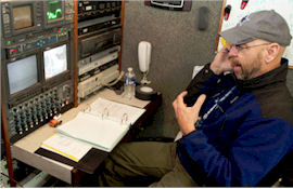
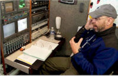
Joe was covering Sandy the Super Storm in WV this month!
So now you have a little insight what the experts think for this year’s weather. It seems that all “in the know” conditions for Appalachian riding (skiing and boarding) will end up being okay this year due to the snowmaking capabilities of all of the resorts in the southeast region and a good shot of the natural stuff. Let’s just hope so.
That’s it for the season’s first column, more to come as the season continues, just remember whether it be cold or whether it be hot, we’ll weather the weather, whatever the weather will be. Think about it! See you on the slopes.
Joe Stevens, a member of the southeast ski industry since 1990 is a regular columnist for skisoutheast.com and serves as the Communications Director for the West Virginia Ski Areas Association.
)