
It looks like today is going to be pretty rough out there. Just about all of the Southeast and Mid-Atlantic resorts are under a High Wind Warning of some sorts (a few resorts just have Advisories). At Appalachian Ski Maintain, for example, the High Wind Warning is in affect from noon today ‘til noon tomorrow with gust up to 65 MPH!
On the flip side, the Maryland, West Virginia, North Carolina, and Tennessee resorts have Winter Weather Advisories. Ober Gatlinburg’s alert calls for rain showers changing to snow showers late this afternoon and evening with snow accumulations of 1-3 inches expected. We have some other great news coming out of Ober. They announced yesterday that they are extending their season to include days next week. Ober is expecting to be open Friday through Sunday, March 21-23, from noon to 8 pm (7 pm on Sunday).
The North Carolina High Country’s alerts state that rain showers will transition to snow this evening and will linger into early Thursday morning. Snow accumulation of 1-3 inches is expected. Up in West Virginia, the alerts call for 2-4 inches of snow expected with periods of intense snow tonight. It will be windy however, with gust up to 45 MPH. I hope some of this fresh snow finds its way to the slopes and doesn’t just blow away. Less than ideal conditions for sure. The wind chills tomorrow morning range from -15 to -25 degrees.
Finally up in Maryland, Wisp’s alert calls for 2-4 inches of snow starting late this afternoon and going to tomorrow morning. Like West Virginia, there will be periods of intense snow tonight with 45 MPH winds tagging along. Wisp can expect wind chills down to 15-25 below zero tomorrow morning as well.
We have a few notable changes in the morning snow reports, along with some thin spots starting to show up on the cams. Appalachian Ski Mountain is down 2-6” to 30-64”.
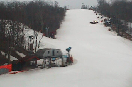
Appalachian Ski Mountain
Beech and Sugar are both down 2” with Beach having 30-82” on the slopes, and Sugar boasting 28-78”. Beech is also down 1 run this morning, closing Crossover since our last update.
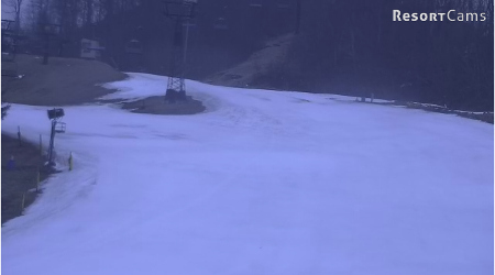
A little thinning at Beech?
Ober lost a bit too, hosting skiers and boarders on their 30-42” base which is down 6” at the bottom estimate and 2” off the top.
The most significant change this morning comes via Canaan Valley. They have closed down 9 runs since yesterday to 29/43 today. Canaan is maintaining a pretty consistent base with 12-24” on the slopes.
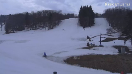
Canaan Valley Ski Resort
We’re in for a pretty wild and somewhat dangerous ride from Winter Storm Vulcan. A couple of the National Weather Service wind alerts warn of dangerous gusts and wind chills well below 0. With the chance of the winds gusting up to 65 MPH, don’t be too surprised if we get a little hesitation from the resorts tomorrow morning.
Needless to say that if you’re heading out today take some wet weather gear and a shell that can protect you from the wind. The temperatures will start to drop pretty quickly as the front moves in with the more northern resorts seeing it first starting early this afternoon.
Take care out there today!
 Tim Bahlke
Drop me an email at [email protected] to let me know what you think or with suggestions on what we could be doing better.